Featured Article
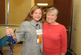
Distinguished Teaching Award Winner Gruhler Honored for Guiding Future Teachers
Dr. Danielle Gruhler, assistant professor of literary education, wanted nothing more than the opportunity to change the lives of students. Since 2002, Gruhler has been doing just that.
read moreNew Wayfinding Initiatives Promote Pedestrian Movement on Campus
Posted April 4, 2011 | Sarah JamesThe next phase in the university's wayfinding plan includes new vehicular and pedestrian signage to better guide both the student and the visitor to and along the Kent Campus's 26 miles of sidewalk. Looking through a visitor's eyes, the new signage first addresses those arriving by car and then, once they have parked, for those walking across the campus.
"These new signs take into account the different ways people read. We tried to make understandable to the majority of people," says Tom Euclide, associate vice president, Facilities Planning and Operations. "Many people have trouble reading maps or understanding north, south, east or west directions. We have to try and develop signage that can be read and understood quickly by all kinds of people."
Vehicular Signs
When Euclide travels to other college towns, the first thing he does is try to find the campus from the edge of town. When visitors reach the city of Kent, they should be able to find the Kent State campus from any direction.
"Our objective was to help each visitor to easily navigate from the city line to the campus", says Euclide.
As visitors get closer, the scale gets more and more refined, more detailed as campus nears. Signs off the freeway point to signs on the highway that connect to signs on the edge of town and link to the university.
The new vehicular signs are equipped with blank slots so departments can direct visitors to special events on campus. The department is responsible for purchasing the letter strips, and parking services installs them.
"We hope to see these special sign slots used for a variety of campus events, from basketball games to camps or conferences" says Euclide. "The more events we post on the signs, the easier it is for the campus visitor to find the event and the more the general public becomes aware of how much is happening on the campus on a day to day basis."
To take advantage of Internet mapping software, all new building identification signs now include street addresses and the building name. Over time, the new addresses will be added to national database systems to make it easier to acquire detailed directions to every building on campus.
Pedestrian SignsThrough research conducted by a group of students in a University Wayfinding course taught by David Middleton, associate professor, Visual Communication Design, Campus Environment and Operations was able to break down the Kent Campus into more manageable chunks: central campus, campus living and front campus.
"Campus isn't a grid. They helped us break down the campus into smaller, more understandable components,' says Michael Bruder, director of design and construction.
The new signs aim to promote pedestrian movement on campus as the snow melts into spring. Signs along the admission's tour path were installed first so first-time visitors can direct themselves without a guide.
Web WayfindingMeanwhile, University Communications and Marketing and Information Services are working on a revamp of the online campus wayfinding website.
"Our current wayfinding system is antiquated, confusing and split across two sites," said Nick Gehring, coordinator of electronic communications and web content services at University Communications and Marketing. "We're working to combine the two sites into one better, easy-to-use application."
Gehring says the new wayfinding site will launch sometime in early April. The new system will have a strong mobile presence and make it easier for visitors and students to find their way around campus. The online map will use Google Maps technology to provide directions and points of interest, such as campus dining locations and computer labs.
Watch for these and other changes to be fully implemented over the summer.
For more information on web wayfinding, contact Gehring at webteam@kent.edu, or for more on the signage initiative, contact Euclide at teuclide@kent.edu .