Featured Article
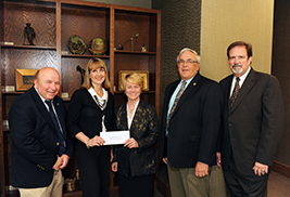
Kent State Helps Put the Dan Smith Community Park Fundraising Campaign Over the Top
A proposed park in the heart of downtown Kent is another step closer to honoring a man who dedicated his life to the community.
read moreKent State Professors Use Satellite Imagery to Better Understand the Landscape of the Cambodian Genocide
Posted June 22, 2015 | Jim Maxwell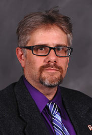
Kent State University Geography
Professors James Tyner, Ph.D.,
(pictured) and Mandy Munro-Stasiuk,
Ph.D.,will study landscapes of mass
violence in Cambodia during and after
the regime of the Khmer Rouge from
1975 to 1979.
Kent State University recently received a $330,000 grant from the National Science Foundation to use historical satellite imagery and archival research to study landscapes of mass violence in Cambodia during and after the regime of the Khmer Rouge from 1975 to 1979.
The collaborative project, led by Kent State Geography Professors James Tyner, Ph.D., and Mandy Munro-Stasiuk, Ph.D., in the College of Arts and Sciences, will focus on the interconnections of environmental degradation, deforestation and mass violence during and after armed conflict.
“This research has important implications for all post-conflict societies in that resource scarcities, including that of water, are assumed to lead to more conflict in the future,” Tyner says. “We need to understand how and why violence sometimes comes about through peace building.”
Following five years of civil war in Cambodia, the Communist Party of Kampuchea, also known as Khmer Rouge, massacred 2 million Cambodians while ruling the country from 1975 to 1979. The Khmer Rouge attempted to boost rice production through irrigation by forcing millions of people into the countryside to work on the irrigation systems, which included the construction of dikes, canals and dams along with prisons and mass graves. These attempts at agriculture reform and rationing led to widespread famine, including the deaths of a million people.
“The Khmer Rouge era is contemporarily viewed as an aberration or a violent blip that is now discounted, but that’s the wrong way to look at it,” Tyner says. “We need a case study.”
This summer, Tyner and Munro-Stasiuk will conduct field research in Cambodia with two Kent State geography graduate students. They want to better understand how and why programs and policies designed to augment both water and food security in the aftermath of civil war may actually facilitate further conflict and violence.
“It is widely understood that water management issues have a bearing on post-conflict societies,” Tyner says. “However, much of the literature presumes that armed conflict contributes to the destruction of these schemes whereas peace-building efforts improve such schemes. This relationship is not so straightforward, in that many post-conflict practices may lead to renewed, but altered, forms of conflict and violence.”
Through both Landsat and KH-9 spy satellite imagery dating back to 1972 and other more recent geospatial technologies, Munro-Stasiuk is currently trying to identify the locations of various Khmer Rouge construction projects and determine how they were built, why they were built and what happened there. The researchers also hope to gain insight on the locations of mass graves.
“Through the satellite imagery, we are seeing the genocide and famine in progress,” Munro-Stasiuk says.
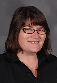
Kent State University Geography
Professors Mandy Munro-Stasiuk, Ph.D.,
(pictured), and James Tyner, Ph.D., will
work to better understand how and why
programs and policies designed to
augment both water and food security in
the aftermath of civil war may actually
facilitate further conflict and violence.
For Tyner, this project is a continuation of research he has been conducting for more than 20 years and includes several expeditions to Cambodia to study the violence that occurred in Cambodia’s “killing fields.” This research also helps the Documentation Center of Cambodia (DC-Cam), an independent Cambodian research institute, piece together the locations and conditions that led to the genocide.
“This is part of a larger research project, which is a reconstruction of the day-to-day economy and political economy during the Khmer Rouge in Cambodia, which hasn’t been done yet,” Tyner says.
Throughout the course of this project, two Kent State geography graduate students, both recruited from Cambodia by Tyner, will be able to contribute through firsthand research to the documentation and empirical interpretation of the genocide. Savina Sirik and Sokvisal Kimsroy, who both lost family members during the Khmer Rouge era, were selected based on their knowledge of the Cambodian genocide.
“When I travel there (Cambodia) and see the landscape, I see green rice fields by a dike and water in the villages which now looks like an ideal rural setting not associated with mass violence, forced labor, death, starvation and disease,” Tyner says. “The tragic events of Cambodia are not marked like they would be here in the U.S., so many of them are unaware of their history. The people who live there live within the memory, yet there is still little understanding of why it happened. So, we need to understand and explain what the Khmer Rouge was trying to do.”
For more information about Kent State’s Department of Geography, visit www.kent.edu/geography.